Woods in Leitrim, Ireland

Woods in Leitrim, Ireland

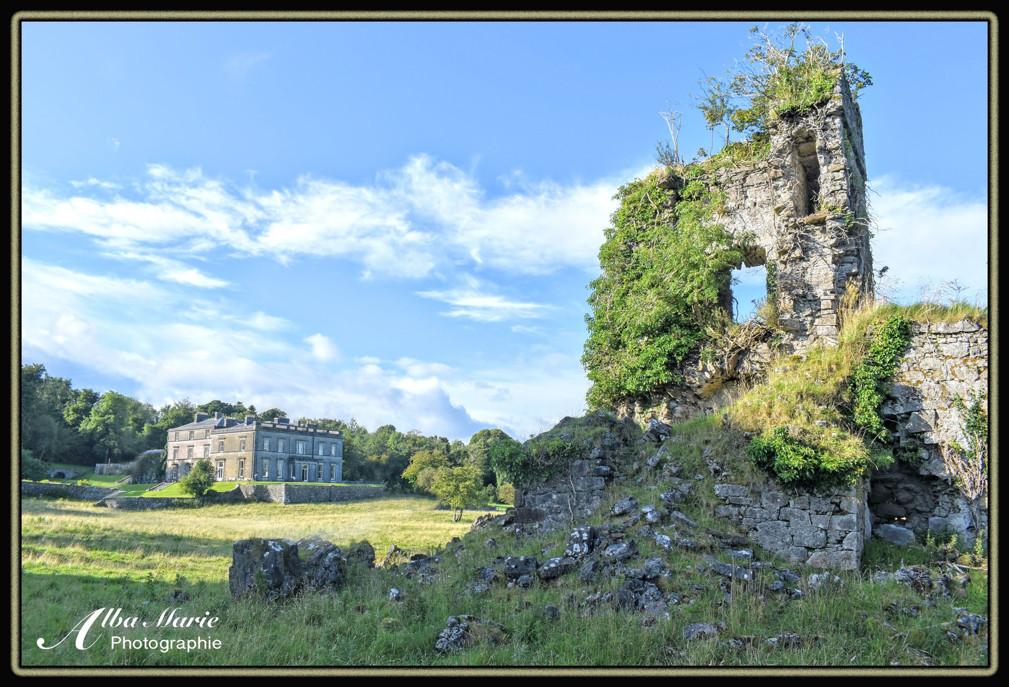
Twisted and gnarled, the damp, temperate climate of Ireland lends itself to green. Every shade and tint of green. Moss clings to the wind-worn trees. Soft ferns uncurl themselves from the thick carpet of dead leaves and bracken. Braids of ivy intertwine the tree trunks, blowing quietly in the wind like wisps of hair. Even as the seasons turn, the hardiest of leaves cling to the branches. And from the forest floor, the next generation of woodlands push through the ground searching for sky, jostling for space amongst Ireland‘s busy forest floor, crowded with mushrooms, ferns, bushes, flowers and animal burrows. The small and remote County Leitrim on Ireland’s west coast is not on most people’s Irish tourist itineraries. Very few visitors could point it out on a map or say anything about this little county; in fact, plenty of Irish from the east coast might be hard-pressed to tell you anything about Leitrim other than “rural farmland.” But if you’re looking for total peace, a place where the modern world is at a standstill, where there are more sheep and cows than people, more barns than houses, more cow-tracks than roads, you’re essentially looking for Leitrim. Green pastures and green forests, green hills and green fields – it’s hard to find a prettier and quieter place to escape from the world for a few days than rural Leitrim in Ireland’s northwest.


Tip: Some amazing Leitrim spots to check out include Glencar lake and waterfall, the nearby Devil’s Chimney waterfall and forest paths, the cute villages of Dromahair and Mohill, the lakeside Parkes Castle and Drumshambo gin distillery.


Seasonal Forests – Further Reading:


Temple House, Sligo, Ireland

Temple House Sligo and Knights Templar castle

Temple House, Sligo, Ireland

It’s a little-known fact that rainy northwest Ireland hides the ruins of a Knights Templar castle – and it’s in the place you least expect: on the grounds of a 4-star manor hotel. The gorgeous Georgian manor, Temple House, gets its name from its Templar connection. Looming dramatically from the windblown fields, visitors will literally stumble over the crumbling ruins of a Templar church and castle just outside the stately home. The house was built in 1825 on a large 1,000-acre estate on lands that once granted to the Knights Templar in 1216. The Perceval family has lived on the lands since the 17th century, and continues to reside on-site today (the current Perceval owner of the house is also your friendly host to anyone lucky enough to snag an overnight stay at the manor house), with just a minor break when the house was briefly sold for lack of funds before being bought back almost immediately by another member of the Perceval family. The Percevals claims to trace their history all the way back to Sir Perceval, a knight of King Arthur’s Round Table, with another ancestor taking part of William the Conquerer’s raid of England. The castle may not look particularly “Templar” but this is because it was modified in the 1600s to fit the trendy Anglo-Irish idyll of domestic castle living. Windows were widened, rooms expanded, and ceilings raised, all in the name of comfort (by the 1600s, invasions in Ireland were a thing of the past as the island was firmly under British rule). Anyone yearning for old-world charm coupled with a connection to history and mythology will love a quiet country break in Temple House surrounded by country comfort and fascinating history from two very different periods of time.


Tip: The breakfast in the lavish dining hall is a fantastic way to start your day. Take the time to chat with owner Roderick; once you get him talking about local history, you’re in for a treat!


More Fascinating Irish History


Bluebell Woods, Ireland

Bluebell Woods, Co. Roscommon, Ireland

Violet and blue flowers erupt in a rich carpet on the forest floor against a background of emerald greenery. The sun peeks through a canopy of lush woodlands sending rays to shine on the forest floor, illuminating the thousands of bluebells dancing in the breeze. The Irish Midlands are too often overlooked by visitors and locals alike who dismiss the whole region as uninteresting without taking the time to find and experience its magic. Bluebell Woods is one such magical place. Each May (and sometimes early June), forests across Ireland come alive with vivid violet floral displays. Hidden down a winding back lane in Co. Roscommon, Bluebell Woods is lovely any time of year, but it enters the sphere of Impressionist painting come May. Wander the laneways of bluebells and breathe in the fresh air – sometimes co-mingled with the scent of fresh wild garlic, marked by its distinctive odour and dots of white petals. Bluebells are native to Ireland and are characterised by their drooping stems and upside-down bell-shaped floors, usually growing in forests or other shaded places. If you’re lucky enough to meander through the forest of bluebells in season, it’s not an experience you’ll soon forget.


Tip: Visit Bluebell Woods (or other similar woods) in May. If you’re visiting the Roscommon woods, we recommend heading to Lovage cafe in Boyle afterwards for refreshments. Lovely people and an ever-changing menu of organic creative dishes. Can’t travel in May? The Burren National Park is also known for its amazing wildflowers which last through midsummer.


More Irish Midlands Near Bluebell Woods


Carrokeel Cairn F, Sligo, Ireland

Carrokeel Cairn F, Sligo, Ireland

Some two dozen cairns dot the highest points of the Bricklieve Mountains, combined to form the Carrowkeel-Keash Neolithic complex. Tucked in the shadows of the towering Keash Mountain (topped with Sligo’s highest cairn, despite most thinking it is Knocknarea Hill), Sligo’s Bricklieve Mountains are among Ireland’s most history-drenched locales. This is Cairn F as viewed from Cairn B – interestingly, two of the complex’s least visited but most impressive tombs. Cairn F is by far the largest tomb, and due to its size and prominent location, it was likely it was the focal point of the ancient site. Dating to the Neolithic period, these tombs are about 5,000 years old, making them older than Stonehenge, the Pyramids of Giza, the Colosseum and many other historical spots that we now think of as “old.” Today, the entry to Cairn F is closed. When it was brutally “excavated” in 1911 by the English “antiquarian” Prof. MacAlister, the enormous capstone was smashed because it was “too heavy to lift” (a horror that still makes archeologists and history buffs angry), though its true that even then, the cairn’s roof had collapsed and the cairn’s interior was filled with debris. Inside, as outside, Cairn F was the biggest of all Carrowkeel tombs with five burial chambers (others contain one or three). At the time, Ireland’s climate was much more temperate, supporting a flourishing Neolithic society on the island. The people who lived here left behind a number of impressive stone monuments all over the island as well as artefacts, burials, and hut foundations, but despite these tantalising clues, there still remains much mystery about Ireland’s ancient Neolithic people and their lives and culture.


Tip: To visit Cairn F, follow the signs to Carrowkeel from Castlebaldwin village. After parking , hike along the regular path that heads towards the Carrowkeel cairns (G-H-K). Once you walk up the first hill, and go around the first bend, look in the heather for a narrow footpath. Hike up this short but steep hill and you’ll find the impressive remains of Cairn E (more on that in another entry), and about 200 m beyond find Cairn F. The tombs can be spotted from Google maps – a good way to ensure you’re in the right place. Martin Bryne’s Carrowkeel site is a wealth of knowledge on the subject.


More Ancient Ireland & Beyond


Castlebaldwin in the Snow, Sligo, Ireland

Castlebaldwin in the Snow, Sligo, Ireland

Everything looks magical in the snow, doesn’t it? Castlebaldwin, a small village in northwest Ireland, is home to the ruins of the “castle” of Baldwin, a small stone manor with a defensive tower on the back of the castle. The castle ruins are complete with gun-slots and a machicolation (an overhanging hole over the down where defender could rain down hot water, hot sand, tar, rocks, arrows or other blunt objects on attackers though rarely boiling oil because that was too expensive). Little is known about this 17th century fortified manor house or its builder, the family Baldwin, other than that they were English, many stones used to build it were once part of a long-gone nunnery, and that the castle’s ceilings were made of wood, not vaulted stone. Judging by the relatively small size of house, the obscurity of the family and its homestead, and the fact that northwest Ireland traditionally has very poor agricultural land, the Baldwins were not likely very wealthy nor high status, and more more likely to be minor lords. Ireland was home to many absentee English landlords who ruled their Irish estates with an iron fist from the comfort of their London townhomes (while the Irish people tilled the lands for very little food or money, living in hovels with dirt floors and not even allowed to practice their own religion – Catholicism – or speak their own language – Irish “Gaelic.”) Today the little-visited castle is a silent and eerie relic of a bygone era, accessed by a new kissing gate on the back road behind the castle and the N4. If you’re lucky enough to visit in winter snow, enjoy the lovely winter wonderland! Happy New Year and welcome to 2022.


Top tip: Castlebaldwin lies just below the stunning Bricklieve hills home to the Carrowkeel passage tombs from Neolithic times 5,000 years ago, and just a few kilometers from Keash Caves. When in the area, it’s worth visiting these monuments. Then head to McDermott’s pub for a pint and maybe a hot meal – on a warm day, their new beer garden is lovely!


Visit Other Local Sites


The Hag of Beara’s House, Ox Mountains, Sligo

The Hag of Beara’s House, Ballygawley Hills, Sligo, Ireland

The Cailleach a Vera or the Hag of Beara was a figure in Irish folklore associated with the coming of winter, rising at Samhain (Halloween, the Celtic start of winter) and waning on St Brigid’s Day (Feb 1st, the Celtic start of spring). Topping one of the peaks of Slieve Daeane in County Sligo‘s Ox Mountains on a backdrop of the iconic Ben Bulben is a neolithic tomb colloquially known as the Hag of Beara’s house. It was common practice for the Irish people of bygone times to create folklore stories of witches and giants, mermaids and fairies and magical bulls and more to explain natural features or Neolithic remains, as they did not understand that such ruins were built by ancient peoples over 5,000 years ago! (i.e. the Giant’s Causeway supposedly being built due to warring giants). Today, the long distance trail the Sligo Way weaves its way through these mountains between the village of Collooney and the shores of Lough Gill. Though not on the path, the neolithic tomb known as the Hag of Beara’s house can be visited by dedicated hikers by leaving the path and heading up the hills. Each hill is topped with a cairn of sorts, but the Hag’s house is on the lowest peak closest to the lake. It can be wet with tall grass, so wear hiking boots and waterproofs, and long sleeves to protect against bugs – but it is well worth the effort for the history, culture and of course the views!


Tip: Looking to refuel afterwards? Gourmet Parlour in Collooney or Tempo Cafe in Ballisodare are delicious local options. Sadly, the Hag of Beara’s house was recently vandalised by someone with a metal detector looking for who knows what. Do not disturb these ancient sites please! Learn more about this and more of ancient Sligo on Martin Byrne’s fantastic site.


More of Sligo


Lough Easkey, Sligo, Ireland

Lough Easkey, Sligo, Ireland

In the half-forgotten northwest corner of Ireland, tucked into a little-known inland pocket is the remote and tranquil Lough Easkey. This small glacial lake is the picture of natural beauty – grassy slopes resting under balding peaks forming a forlorn valley, home to the quiet shores of the lake itself. County Sligo’s Lough Easkey is a place of haunting beauty – the countryside is desolate, the lakeside cottages long abandoned, now providing shelter for the mountain sheep. The terrain underfoot is boggy and wet, and despite the way-marked path, expect to get wet. The trail that encircles the lake is about 6-7 km in length, and is one of Sligo’s most beautiful and little-known paths, though only recommended for those with proper waterproofs and boots. In fact, the 80km/50 mile long Sligo Way runs alongside one side of Lough Easkey before veering down rural lanes. Hike Lough Easkey on a sunny day and you’ll be rewarded with stunning views and a tranquil atmosphere. Hike here on a grey day and feel the desolation that past generations of inhabitants must once have felt. Do be sure to take the shoes off and dip your feet in if you hike on a warm day!


Pro tip: The seaside town of Enniscrone isn’t too far away. We recommend La Piazzetta pizzeria – delicious authentic pizza made by the friendly neighbourhood Sardinian Danny. Grab a delicious takeaway pizza down to the beach to watch as the sun sets over the waves.


More Sligo Hiking: 


Caves of Keash, Ireland

Caves of Keash, Ireland

Caves often get a bad reputation as dark, scary, suffocating. Caves are where the bad things live, right? Bats, bears, witches, you name it. Caves are easy to get lost in – physically lost, and unable to find your way back, or lost to other dimensions, as seems to happen in most fairy stories and myths. You go into a cave and find another world – you stay for a day, and come back to find a year has passed. This is both true and untrue for the Caves of Keash (or Keshcorran, as they are also called). Tucked away in a quiet corner of County Sligo – which is already a quiet corner of Ireland – the Caves of Keash are 16 openings in the steep limestone slopes of Keash Mountain. Archeological excavations here have uncovered centuries-old animal bones – the remains of long-ago meals – the bones of a medieval friar said to have been killed here, and even an impressive Viking comb. And folklore has it that one local woman, while chasing a stray goat into the caves, accidentally travelled to the dimension of the fairies and much to her disbelief, came out the mouth of the Oweynagat Cave in Roscommon, some 40 kilometres away! Though the walk there is short, the caves are well worth the steep climb for anyone passing through Sligo. 


Pro tip: Find Keashcorran on OS map 25. To access the caves, park at the village and walk up the road to the trailhead (about 3.5km total – boots are preferred but not required). At the time of writing this, work on a small car park at the trailhead base is ongoing, shortening the walk to about 2km. Fancy finding the cairn perched atop the mountain? Access it from the other side of the hill. Park at the small car park at Lough Labe, walk south past the farm to the first farmer’s gate on the right, and follow that to its end. From there, follow the gully up to the stone fence, and walk along that fence until you can see the cairn. There’s no path and its rough terrain, so wear good boots. 


More of Sligo: 


Lavagh Abbey, Sligo, Ireland

Lavagh interior

Lavagh Court Abbey, Sligo, Ireland

Irish history isn’t always sunshine and roses. Much of it is fairly dark, oppressed for years under British rule. Remember arrogant (sexist) Henry VIII who couldn’t produce an heir due to his own inbred nature but kept blaming his wives? He decided to start his own divorce-friendly religion, which gradually took over and then punished Catholicism. across all English territories. In the 1500s, the Dissolution of the Monasteries swept across the nation, forcing the abandonment of Catholic monasteries. The crumbling Lavagh Court Abbey in southwest Sligo was no exception. Built in 1454 as a Franciscan Friary, Lavagh sits at the base of Knocknashee Hill (‘hill of the fairies’), which for centuries was held sacred by the pagans (Christians are like Hollywood directors – to get a wider audience and easier job, they ‘borrow’ stories, concepts and sacred people and places from other religions they were hoping to wipe out, something they did successfully in Ireland). Once home to both brothers and sisters of the order, Lavagh is a simple rectangular church topped with a squat stone tower and joined with a chancel. Containing extensive burial sites, it has now been taken over with ivy, plants and flowers. As you wander the burials outside, keep an eye over the walls of the far side – you’ll see an earth-topped stone cashel (ringfort), at least half a century older than Lavagh itself. (What more? Check out well-preserved cashel like Cashelore or Clougher Fort). Follow the path through the half-forgotten wind-beaten graveyard through the small ivy-clad door into another world. Greeted with an earthy, natural smell, Lavagh’s sacred stone walls are wallpapered in crisscrossing ivy and blanketed in soft earth and rustling leaves. Lush and emerald, the massive greenery-wrapped arch feels like a scene out of Narnia. Wandering this ancient, abandoned site, drink in the eerie, moody atmosphere and feel the weight of Mother Nature, a far older god than the one Lavagh was originally built for. This place is surely enchanted with ancient fairytale magic – and chances are, you’ll have it all to yourself.


Pro trip: When visiting this corner of Sligo, you have to climb Knocknashee Hill. Most people climb it via the far side, parking at Gilligan’s World, and passing through the farm gates to climb the very steep slopes to the top. But there is a new path from the Lavagh side being constructed, though process has temporarily halted due to CV-19. At the top, find ancient cairns, forts, and village foundations. Interested in the changing site of Lavagh? Take a look at Sligo artist Wakeman, and his famous 19th century drawings of Sligo monuments


More Ancient Places in Ireland’s Northwest


*Please note that all photos posted since the start of the Pandemic travel restrictions are from the archives, or taken locally within a short distance of our home. 

Carrowkeel Cairn B, Sligo, Ireland

Carrokeel cain B

Carrowkeel Cairn B, Sligo, Ireland

Carrowkeel is one of Ireland’s four great Neolithic-era complexes (the others being Newgrange and the Boyne Valley; Loughcrew, and Carrowmore, also in Co Sligo). It is also arguably the best. This little-known site is off the beaten path for most people, and even locals sometimes forget it’s there. Carrowkeel comprises of 14 tombs, with another 12 in the surrounding half-dozen kilometres. The tombs, or cairns as they are called, date back to the Neolithic era, and are about 5,000 years old. For reference’s sake…. that’s older than Machu Picchu, the Roman Colosseum, Stonehenge, and the Pyramids of Giza. Far older, in most cases. From the small car park, it’s a 5km roundtrip hike to Cairns G, H, and K, which are the most popular tombs (each tomb has a letter). The cairn you see high up on the hilltop to your right? That’s Cairn B – one of the least-visited and most amazing (and visible) tombs of all Carrowkeel. Like the others, it was opened when early 20th-century English archeologist Macallister “excavated” it. This was the height or barbaric English archeology, and his team was… less than gentle with this ancient, sacred place. More than one tomb suffered dynamite and tunnelling, most had cremated remains removed for “testing” (never to return to Ireland), and even other artefacts such as pottery removed and taken from Ireland. Cairn B is a simple passage tomb, with a short 1-2 metre long narrow passage (ungracefully on your hands and knees) to get inside the main chamber. In use for hundreds of years, these cairns would’ve housed the cremated remains of the local Neolithic people’s ancestors, visited regularly for mysterious rituals that we still don’t understand today. It is an amazing place.


Pro tip: Aligned with the Summer Solstice, come here to watch the sun set on the longest day of the year. Cairn B is little visited – most watch the light enter Cairn G’s chamber through the narrow “roofbox” opening. To get here, instead of turning left onto the small road to Carrowkeel from Castlebaldwin, keep straight. After the first large house, park and follow the farmer’s fence to the top. No trail and rough terrain, but the grade isn’t steep. 


Neolithic Europe:


*Please note that all photos posted since the start of the Pandemic travel restrictions are from the archives, or taken locally within a short distance of our home. 

Donegal Castle, Ireland

Donegal castle

Donegal Castle, Ireland

Wild and rugged, Donegal is a half-forgotten county in northwestern Ireland, cut of geopolitically from both Northern Ireland and the Republic of Ireland. Its capital is Donegal town, which is home to Donegal Castle. The castle was built by the infamous Red Hugh O’Donnell in 1454, possibly on the site of an old fort, though no evidence remains. At this time, Ireland was divided into fluid regions, each ruled by a clan and led by a local chieftain. Because of the region’s remoteness as well as its poor agricultural terrain, Donegal and the the rest of the surrounding region of Ulster were the last to be conquered by the English. Red Hugh’s impressive fortress, stronghold of the O’Donnell clan, started life as a tower house, the most common Irish medieval fortification. In an attempt to get the chieftain’s under English control, the clan leaders where given the title of Earl. Not content and craving freedom, the Earls rebelled. The uprising was a failure, leading to the Flight of the Earls in 1607 and the total control of Ireland by the English crown. As was the custom, the English seized the castle from Irish ownership, and passed it on to a loyal Englishman as a reward for service – in this case, a fellow called Brookes, who later sold it to the wealthy Sligo-based family, the Gores. Brooke added the Jacobean manor-house to the left of the towerhouse, transforming it from military might to countryside estate. Sadly under the Gore family, Donegal Castle fell into ruin (likely to avoid paying taxes on it), and there it sat in quiet abandon until the 1990s, when the Irish government restored it. Today, it is one of Donegal’s most important parts of cultural heritage.


Pro tip: Donegal is well-known for tweed. Check out any number of tweed shops in town, or head over to Magees of Donegal for bespoke tweed garments. If you’re looking for a cosy tearoom and lovely pastries or light meals, try the Blueberry Tearooms in the town centre.


Nearby in Donegal & Northwest Ireland


*Please note that all photos posted since the start of the Pandemic travel restrictions are from the archives, or taken locally within a short distance of our home. 

Ballindoon Abbey, Sligo, Ireland

Ballindoon Abbey, Sligo, Ireland

Ireland is spilling over with ancient ruins, from the Neolithic through the Middle Ages to Georgian mansion and 20th century cottages. There are a lot of abbeys and friaries and priories in Ireland, and the majority of them are a lot like this one – in ruins. This we can blame on the terrible Englishman Oliver Cromwell whose horrid armies swept through Ireland in 1649 in order to “put those troublesome Irish back in their place” (I mean, how dare they ask for the right to rule themselves, speak their own language, or practice their own cultural traditions). He stomped through Ireland, burning and pillaging as he went. Even upon returning home, he left his son-in-law to continue his awful work. Ballindoon Abbey (also called Ballindoon Priory) is just one of many Irish abbeys to suffer at the fate of the disillusion of the abbeys. This gorgeous place rests quietly on the shores of Lough Arrow in Co Sligo. Built in the 14th century in the Gothic style, Ballindoon Abbey is small compared to some, but it is well preserved. It is has still been used in recent times as a gravesite. The tower overlooks the rest of the church, though there are stairs on the exterior, they are no longer usable. Ruined as it is, Ballindoon is a quiet place. Sitting on the pensive shores of a little-visited lake in a remote corner of Ireland, Ballindoon is picturersque, lonely and hauntingly beautiful. It is a testament to a long standing tradition and Ireland’s complicated relationship with both religion and England. Bring a camera, book and thermos of tea, and curl up here to escape from the world (likely met by the farmer’s cheerful black labrador pup!)


Pro tip: You’ll need a car, but Ballindoon Abbey is part of a supurb day trip from Sligo. Head over to Carrokeel tombs (5,000 years old!) for a 5km return hike to the tombs, then over to Lough Arrow to visit Ballindoon Abbey and up the hill behind Cromleach Lodge to visit Labby Rock. Hungry? On weekends, bounce over to Ballinafad Café (right next to the castle!) for a cosy community cafe for a cuppa and homemade treats, run 100% by volunteers in the community. 

Visit Near Ballindoon Abbey


*Please note that all photos posted since the start of the Pandemic travel restrictions are from the archives, or taken locally within a short distance of our home. 

Knocknarea & Cullenamore Strand, Ireland

Knocknarea reflections.jpg

Knocknarea & Cullenamore Strand, Ireland

Knocknarea is a very special place. Tucked away in a quiet corner of northwest Ireland on a little peninsula in County Sligo, Knocknarea is renowned for its history and legends. Though only 300 metres high, climbing to the top of this hill is a sacred act. Crowning this hill is a huge cairn from Neolithic times – over 5,000 years old! Sligo is riddled with ruins from the Neolithic era – at Knocknarea’s foot are the Carrowmore tombs (home to some 50 monuments!), and further inland, find the even more impressive Carrowkeel tombs – 20 monuments of which three are opened. There are other sites of course – Deerpark, Creevykeel, Knockvranny, Knocknashee, and so many more – and these are all in wee County Sligo! You could spend a lifetime trying to visit all of Ireland’s Neolithic sites… But yes, back to Knocknarea. Other than the huge cairn, there are a few satellite tombs, and the ruins of an ancient village (as well as a famine age abandoned village – both just a few houses). After Ireland was Christianised, many early Christians hung on to their beliefs, and the religious leaders had to find a way to compromise – such as Yule becoming Christmas, the Pagan goddess Brigid becoming a saint, and the fertility goddess Sheela na Gig giving Mary a higher status than in most contemporary – and patriarchal – Christian societies. And then there was the problem of understanding those societies who came before these early Christians (who were they, and why did they build these things!? Questions still unanswered today…). Knocknarea was therefore explained away using folklore. The cairn was attributed to the legendary (and semi-mythical) saviour and warrior queen of Connaght, buried upright in her great tomb under the cairn, facing her enemies from the North. Though this story is unlikely to be true, it’s clear that someone (well, many someones) are buried here, making this an ancient graveyard of sorts. It is one of Sligo’s iconic spots and can be seen from almost anywhere around Sligo town. Knocknarea is seen here from the far side reflected in the low tide sands of Cullenamore strand, a quieter alternative to busy Strandhill Beach – and also better for a long walk on the beach!


Pro tip: Don’t forget to bring a stone from the bottom of the hill up to the cairn for Queen Maeve! If you have a car, climb from the Queen Maeve Car Park. No car? Take the Strandhill bus and stop at the Centra – there is a path up this side starting here. A new path connects both sides with the Strandhill beach, famed for its surf. We recommend lunch/brunch at Shells, ice cream at Mammie Johnson’s and/or pizza and a pint at The Strand pub.  


Other places in Sligo


Cliff Baths ruins of Enniscrone, Ireland

Enniscrone, Sligo, Ireland

Cliff Baths ruins of Enniscrone in Co Sligo, Ireland

The west coast of Ireland is a magical place. Timeless and unspoilt, the west coast has managed to keep an aura of otherworldliness. Full of historical and natural wonders,  County Sligo is a little-travelled place of fantastic hiking, breathtaking coasts, ancient Neolithic monuments and crumbling abbeys. Enniscrone is a little seaside village where waves crash against rocky headlands and wind sweeps over sand dunes, paired with 5km of beach strand perfect for bathing – if you’re willing to risk Atlantic temperatures! Rising out of the edge of the sea on the foot of Enniscrone are the ruins of the Victorian era Enniscrone Cliff Baths, a strange sort of castellated little building. The Cliff Baths were built in 1850 by a wealthy local family, the Ormes, who owned large tracts of land in Sligo and Mayo. The Ormes, wanting to turn Enniscrone into a fashionable beach resort town, built the lodge and the baths to attract the fashionable crowd. They even built a man-made tidal pool in front of the Cliff Baths in order to ensure that all baths would be supplied with fresh seawater no matter the tides (today its a popular spot with local kids). Little remains of this once-luxurious resort bath, and it has been allowed to fall into disrepair, helped along by the the crash of the tide, the gusts over the Atlantic, and the salty seawater in the air. Today it is simply an idyllic place to take dramatic photography!


Pro tip: Book a seaweed bath at the more modern bathhouse, Killcullen Seaweed Baths, or head north along the coasts to Voya Baths in Strandhill. 

More Beautiful Coastlines


Moygara Castle, Ireland

Moygara.JPG

Moygara Castle, Co Sligo, Ireland

Moygara Castle is a brilliant ruined castle tucked deep away in exactly the middle of nowhere. Northwest Ireland‘s rural and overlooked County Sligo is already a little-visited region – and Moygara Castle is in perhaps Sligo’s least-known corner. Named for the once-powerful O’Gara family – who ruled Lough Gara and nearby relands since the 1200s – they needed a castle to show off their status, and act as defence during troubled times. Three castles were erected, though Moygara Castle is by far the best example and the only properly surviving structure. Starting out as a typical Irish tower house (a large, rectangular structure built by landowning chieftains found throughout Ireland),  Moygara Castle later expanded to include 4 towers connected by high stone walls, a gatehouse (now in ruins) and a massive courtyard. The side gate is still intact, but its precarious keystone has caused this entrance to be closed off. Instead, visitors should walk all the way around the castle, where a hole chuck of the wall is missing, which acts as the castle’s main entrance now. Attacked in 1538 by the famous chieftain O’Donnell and later by some mercenary Scots in 1581, the castle has fallen into ruin. Much overgrown by trees and vines, Moygara Castle is slowly being reclaimed by the hills surrounding Lough Gara, a place that has been inhabited for thousands of years (it has one of the highest concentrations of crannogs – manmade islands built for defensive purposes but also lived on). Today, Moygara Castle sits in a field inhabited by cows and sheep, on a tiny country lane, far from a main road or village. Few people know it’s there, and still fewer visit it. Chances are, you’ll have this magical piece of history to yourself!


Pro tip: Moygara Castle is located on a working farm, so be careful and respectful. Don’t bring your dogs, and be sure to close any gates you open. It is also quite mucky, so wear good boots! Hungry? In nearby Boyle, check out the rural town’s many cafes and pubs such as the lovely riverside Lovage cafe. Afterwards, duck into “Ireland’s smallest bookshop” to find your next good book. 


Other Places in Northwest Ireland’s counties Sligo & Roscommon


Wee Irish Cottage, Dromahair, Ireland

wee blue cottage in Ireland

Wee Cottage on the Sligo Way, Dromahair, Ireland

When one envisions the Irish countryside, often quaint stone cottages with thatched roofs, with a garden of dancing flowers on backdrop of rolling emerald hills comes to mind. A lot has changed since this type of Ireland was the norm. Ireland (which was a 3rd world country until about a generation and a half ago) has modernised, become part of the EU and joined the 21st century. And yet, when you are wandering in the countryside – particularly in the rural parts of the west coast, in places like Sligo, Donegal, Leitrim, Mayo, Roscommon and other similarly rural and agricultural counties, you will still find pockets of this old world Ireland, such as this wee little cottage outside the village of Dromahair that maintains traditional thatched roofs and stone structure (though it’s a vivid shade of blue!). The best way to uncover the real Ireland is by pulling on a pair of hiking boots and set of traipsing through the woods, as Ireland’s outdoors has so much more to offer than Ireland’s towns or cities. This particular cottage is along the final stage of the little-known Sligo Way, a nature and cultural track that winds its way through some of Northwest Ireland’s most scenic destinations. Not only is hiking in Ireland – especially in the remote and undiscovered northwest – a good way to explore the island, but it’s also a great escape from our busy, fast-paced, screen-driven lives of modern society. Instead, kick back, relax and enjoy a slower – albeit muckier – way of life in the remote corners of Ireland!


Pro tip: The Sligo Way is 78 km long, but the final 10km are by far the best. Nearly all off-road, the landscape and backdrop varies from lush woodland, tranquil lake shore, to mountain path, farm track and boggy ground. It passes the famed Isle of Inisfree, the ruins of Creevylea Abbey, a donkey farm and lovely cottages like this one, before ending in the charming village of Dromahair. 


Other lovely places in Ireland to visit:


Horn Head, Donegal, Ireland

Horn-Head

Horn Head, Donegal, Ireland

Welcome to the ends of Earth – or at least, that’s a bit what Donegal feels like. The Republic of Ireland’s northernmost county also contains the island’s northernmost tip, Malin Head – used as a Star Wars filming location (a stand in for the backdrop of Luke Skywalker’s hideout). Donegal is nicknamed the Forgotten County – and for good reason. It is one of Ireland’s most remote regions, as well as one of its most sparsely populated. It’s cut off culturally and geographically as it is blocked by ocean on one side and the UK (via Northern Ireland) on the other. It was the last region of Ireland to fall to British rule, who then tried to establish and maintain their power in this volatile region by naming the local chieftains “Earls” – a title against which they rebelled and subsequently were defeated and driven away, henceforth known as the Flight of the Earls. Perhaps because of this, Donegal has a high proportion of Gaeltacht (Irish-speaking) communities. On Donegal’s rugged northern coastline stands the devilishly named Horn’s Head Peninsula – so named for twin rock formations that resemble horns. Today, it retains its wild side. It is also the Wild Atlantic Way’s northernmost section. Alongside Mayo, Donegal is about as close to true wilderness as Ireland gets! Desolate boglands, sheer cliffs, jagged headlands and vast heathland dotted with hardy mountain sheep, Horn Head is a place that works as a time capsule, transporting the weary wanderer to another place, another era, another world.


Pro tip: Unlike Scotland and Scandinavia, Ireland does not have the same Rights to Roam. When hiking on private land (most of land in Ireland), be sure that the landowner has given permission for hikers to access their land. Usually this is the case if there aren’t any signs put up. Use stiles when available, but if you do need to open any gates, make sure you close them after you (even if you found them open). 


Other Wild Places in Europe


Boyle Abbey, Ireland

boyle-abbey-v2

Boyle Abbey, Ireland

Boyle Abbey in the Irish midlands, was Connacht’s (one of four traditional regions of Ireland) first Cistercian monastery. Founded in 1142 (though not consecrated until 1218), Boyle Abbey was built alongside the skeletal shell of an abandoned Celtic monastery. Cistercians, also called Bernardines or sometimes White Monks (for their garments), are a Catholic order of monks and nuns from Cîteaux, France (near Dijon) that were a highly influential religious sect under the renowned influenced of famed Bernard de Clairvaux.  Widespread across Europe, the Cistercians founded hundreds of monasteries, abbeys and daughter houses. Though the Cistercians seemingly found it difficult to settle down in Ireland, they finally found their home in Boyle, growing quite successful at founding many daughter abbeys and monasteries throughout the region. Unfortunately, much of the beautiful cloisters and other fine architectural details are lost today. In 1645, Boyle Abbey was besieged by the evil Oliver Cromwell and his English army of hooligans, who spent the better part of four years (from 1649–53) murdering, destroying and causing terror and mayhem across Ireland for the sole purpose of conquering Ireland in order to steal their land and force them under English and Protestant rule. Of course, Ireland was predominantly Catholic (and thanks to the misogynistic tyrant Henry VIII, the English were very strongly Protestants) – all of which lead to the Penal Laws that effectively outlawed Catholicism in Ireland. Poor Boyle Abbey was once again ravaged in 1592, this time when it was transformed into Elizabethan barracks – soldiers’ quarters and a base for the English army – because what better way to assert dominance over your colony than use a monastery as a war engine (the British don’t fare well in Irish history…). Archeologists, historians and conservationists have attempted to recover and conserve the abbey as much as possible, carrying out both repairs and archeological surveys – leading to both a new wall and some interesting finds – with the abbey presented as it would have been under the Cistercian command.

Tip: Today, Boyle Abbey is under the care of the OPW (Ireland’s public works office) so check opening hours before you go, and be prepared for poor weather conditions as most of the tour is outside. Afterwards, eat at the deliciously organic Drumanilra Farm Kitchen, or head to the Book Lady for a bit of reading material, Ireland’s self-proclaimed smallest bookshop.


Find More Lovely Sites in Rural Ireland


Hidden Glen in Sligo, Ireland

hidden-valley

Sligo’s Hidden Glen on the Coolera Peninsula, Ireland

Sligo in itself is a little-known corner of Ireland. Located on the northwest section of Ireland’s Wild Atlantic Way, it is known as the Surf Coast for good reason. But for those who venture inland, Sligo is full of gems – fascinating mountains, ancient neolithic monuments, vibrant towns, quiet beaches, delicious seafood, rich mythology. One gem you won’t find on the traditional tourist track is the Hidden Glen, on Sligo’s Coolera Peninsula, a region once home to ancient Neolithic peoples. The Hidden Glen (or The Glen) as it’s known locally, is tucked under Knocknarea Hill. The entrance is as unremarkable as it is hidden – simply a rusty gate and trail off the ocean side of Woodville Road. Pass through this narrow, natural doorway and you’ll find yourself in a another world straight from the pages of a fairytale book. This narrow ‘micro-valley’ is a magical glen where handmade swings hang from soaring trees. Spellbinding stone walls rise up some 60 feet on either side of this narrow chasm deep in a magical woodland. Forget rose-coloured glasses – the verdant ferns and thick green leaves of the Hidden Glen make it feel like you’re seeing the world through emerald shades. If fairies were to exist, then surely this must be their home. Enchanted and magical, this ancient wooded world contained inside the glacially-hewn walls of the Hidden Glen under the watchful eye of mythical Queen Maeve’s tomb atop Knocknarea Hill is the pinnacle of any fairytale experience and is a place you simply have to see with your own eyes. Pro tip: The Hidden Glen is almost always extremely muddy underfoot so only attempt with study, waterproof hiking boots. 


Find Other Fairytale Locations in Europe


Knocknarea Hill Sunset, Sligo, Ireland

Sligo Knocknarea Hill

Sunset over Knocknarea Hill, Co. Sligo, Ireland

Though it may be hard to see from here, Knocknarea is topped with a magnificent stone cairn, shaped like an overturned bowl. Dating back to the neolithic times (so, some 2,000-3,000 years old…), a cairn is a loose dry-stone (without mortar) pyramid, usually located in a desolate or altitude location, and used as a tomb. Ireland is full of these neolithic monuments of varying shapes and sizes. Though generally simple, many of these monument pre-dates the Pyramids of Giza, and have changed very little in past millennia (thanks to local Celtic peoples thinking they were either cursed or protected by the fairies). Even today, projects get diverted in order to avoid touching these ancient sites. Knocknarea is a small hill in northwestern Sligo, overlooking the Atlantic Ocean, Coolera Peninsula, and Sligo town. The cairn is legendary queen of Connacht Queen Maeve’s burial place – supposedly buried standing up, spear in hand, ready to face her enemies.


Pro Tip: There is more than one way up but the best way starts from the Queen Maeve car park. Bring a stone up from the bottom of the hill to add to Queen Maeve’s cairn for good luck! Back in Sligo, have dinner at the delicious Coach Lane (pub – not restaurant – it’s the same cook but cheaper food!) and go for music and drinks at traditional pubs like Shoot the Crows and Connollys or craft beer pub, the Swagmans. 


More Amazing Sunsets in Europe


Knocknarea Mountain, Ireland

dog jumping

Happy Pup near Knocknarea Mountain, Ireland

Nothing beats the look of joy on a happy pup’s face, and this real-life teddy bear dog’s expression is pretty good. Ireland – being an island! – has plenty of coastline and therefore, plenty of sand dunes; perfect places for happy skipping and running if you’re man’s best friend! Pooches aside, Strandhill sand dunes are a wonderful place for a quiet, coastal walk, but for a little more of a challenge – and for stunning views of Strandhill village, the Atlantic Ocean, and the vast, windswept landscapes of Co. Sligo made famous by Irish poet, W.B. Yeats, climb to the top of Knocknarea. The views are worth it! Along the way, you’ll pass a ruined famine village (i.e., a village abandoned during the famine years due to harsh climes). Surrounding tombs date to Megalithic times (2,000-5,000 BC) – and no one knows exactly how the ancient people got the rocks all the way up there! At the summit, you’ll be confronted with legendary Irish warrior Queen Maeve’s massive tomb (called a cairn, it’s essentially a huge pile of rocks). Bring a rock to add to the pile for good luck, but beware – removing any stones brings on the (very) bad luck!